
Good Old Days Festival: Barellan Town Tour
Heading to Barellan for the Good Old Days Festival? Make a little extra time to get to know the town beyond the festival grounds. With its distinctive silos rising above the surrounding wheat country, Barellan is a small Riverina town with strong ties to the farming community around it. Those agricultural connections are at the heart of the festival, making the weekend a lovely opportunity to get to know the town itself.
The name Barellan is thought to derive from barralong meaning ‘meeting of the waters’. The railway arrived in 1908, a year before the town was officially proclaimed, connecting Barellan to Temora (and Sydney). Today, this self-guided tour offers a closer look at the landmarks and stories that give Barellan its character. Jump in the car or hop on your bike, leave time for a few stops, and enjoy your stay.
Need to fill up the tank before heading off? Unleaded and diesel are available 24/7 from South West Fuel, Barellan. If you’re travelling in an electric vehicle, there are EV Charging Stations located in Narrandera.
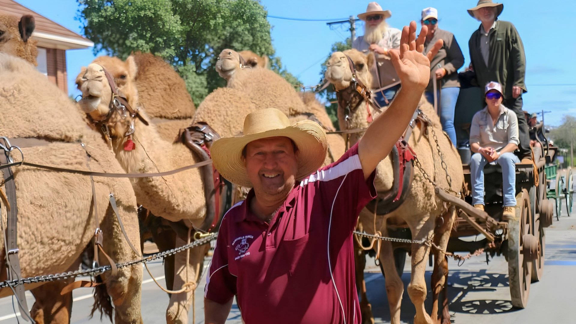
This tour has been contributed by Barellan Clydesdales Committee Assistant Secretary, Vicki Harris. Behind Barellan’s much-loved Good Old Days Festival is a committee with a passion for the town and its history. It’s their dedication that brings history to life for new generations each year at this iconic Australian festival.
Set your trip meter to 0.0km and follow the directions below.
0.0km • Start
Start at the gates to the Barellan Showgrounds. Turn left, go past the silos and stop at the STOP sign.
0.5km • The Silos
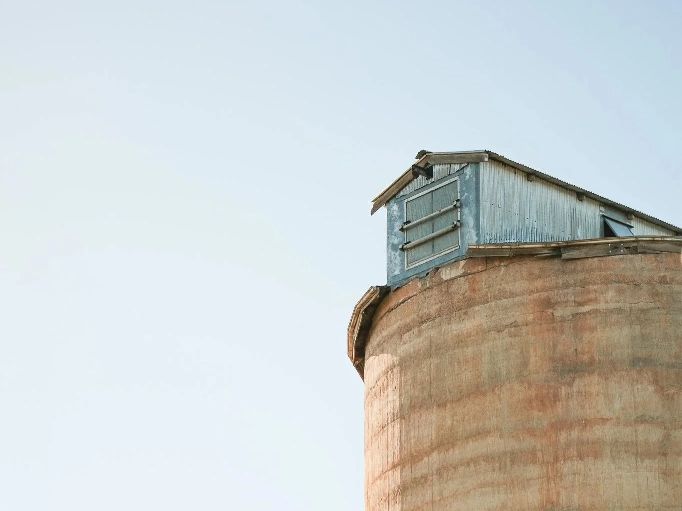
The Barellan Silos are the second biggest receival site in Southern NSW. During Harvest, they average approximately 7000 – 9000 tonnes a day, with approximately 300,000 tonnes received in an average season. At the back of the silos are bunkers which are used as overflow areas, to meet storage needs during peak season. The silos in Barellan take wheat, barley and canola.
If you wish to turn left straight after you have left the showgrounds, you can see the area used for overflow storage. If you complete the Sandy Creek Drive, you will go past this area.
Turn left over the railway onto the Burley Griffin Highway
1.2km • The Water Towers
These are the main water supplies for Barellan. The water comes from Temora.
1.6km • Turn right into Cemetery Road
1.7km • AGnVET — Agricultural Supplies
The 160-foot-high tower in the middle of the lot was built locally by volunteer community members to provide more accurate positioning when using GPS on their farms. Normal GPS’s function off the satellites in the sky, which move. By adding this additional fixed-point tower, farmers are guaranteed accuracy in their paddocks to 25mm, when using harvesters, tractors etc. Farmers ‘move’ their crops over a little every year to avoid compressing the soil where the previous year’s tracks have been.
As you make your way down Cemetery Road, keep an eye out for this year’s crops, starting with oats followed by wheat on your left.
As a general rule, wheat is planted around ANZAC Day and then stripped (harvested) in November/December (although different varieties have different growing times). Wheat is usually stripped after oats and canola. These are the three main crops around Barellan. At the moment, the wheat still has a green tinge to it. It doesn’t get stripped until the green has changed to a golden colour and the seeds in the head are hard. Some farmers test to see if the wheat is ready, by picking a couple of heads, rolling them in the palms of their hands (to remove the husks) and then ‘chewing’ the seeds, just like ‘chewing’ chewing gum.
When stripped the wheat seeds are trucked immediately to the silos, or are stored on farm in private silos, until sent to markets. Depending upon the grade of the wheat, it has different uses e.g. pasta, bread products or stock feed, to name a few.
There’s more wheat on your right and as you drive around, you will notice some paddocks still have a touch of ‘yellow’. Four weeks ago, canola crops were bright yellow, with the canola in flower. The canola seeds are about the size of a pin head. (In a good year, they are a bit bigger). When stripped, the canola seeds are stored on farm, or taken to silos somewhere, often Ardlethan.
3.0km • Peas on right.
These are not green peas you buy for dinner. These are legumes for stock feeds, human consumption or soil development.
4.3km • On your right there are Lupins and, on your left an Old Dam Bank
There are often rabbits to be seen on this dam bank.
4.6km • Cemetery
Once you have had a look through the Barellan Cemetery, return down the Cemetery Rd to the Kurrajong Rd turnoff.
6.8km • Turn left into Kurrajong Rd
If you see a ‘puff of smoke’ as you ride (or drive) along, chances are you have just witnessed the Cypress pines self-pollinating. The area along this road is known as a town common.
7.6km • The big white ‘shuttles’ on the right hold about 1000 litres of chemical used on farms.
8.3km • Metal sculptures on the right in the front yard
8.6km • Wooden Cow yard and Cow Bale on left
Imagine having to find the cow and calf each afternoon and get them into the yard in the cold of winter, or heat of summer.
Turn right into Myall Street
8.8km • Anglican Church on the left and Barellan Central School Oval on the right
If you look down the road to your right, you will notice that the road is not a thoroughfare. It was blocked off, so that the kids from the school could easily cross from the school buildings to the play areas, safely
9.1km • Turn right into Mulga St for Goolagong Courts and Evonne’s Wall
The Barellan War Memorial Tennis Club practice wall, where young Evonne Goolagong-Cawley spent hours hitting a ball, still stands in Mulga Street Barellan. In 1956, across the back lane from the Goolagong home, the Barellan War Memorial Tennis Club was built. The practice wall, where young Evonne Goolagong-Cawley spent hours hitting a ball with a small homemade wooden bat, still stands.
Take your own tennis racquet to have a hit or simply take your photo in front of this unique piece of Australia's tennis history. The town basketball courts are next door.
9.2km • The Barellan Pool
The Barellan Pool was officially opened in 1964, being funded by the local community members. It was built following the tragic drownings of two children in a dam a couple of years previously. The pool has produced many state level swimmers since its inception and the town swimmers of the early 2000’s benefitted from regular coaching sessions by the Olympic Great Dawn Fraser, who regularly coached in Barellan for many years.
The ’Baby’ Pool was rebuilt last year and features a ‘walk-in sloping beach’ style entrance instead of steps.
Barellan Central School
Barellan Provisional School (A Provisional School had to have 15 students), was opened in 1912 and became a Central School (Kindergarten to Year 12) in 1947. The library building was originally The Monia Gap School. It was moved to Barellan, a distance of 80kms in 1976. The original fencing of the school was completed around 1914, after requests from the inspector at the time. One of the reasons given, was that ‘swaggies were camping on the front porch of the school’.
Today the school has about 75 students, Kindergarten to Year 12.
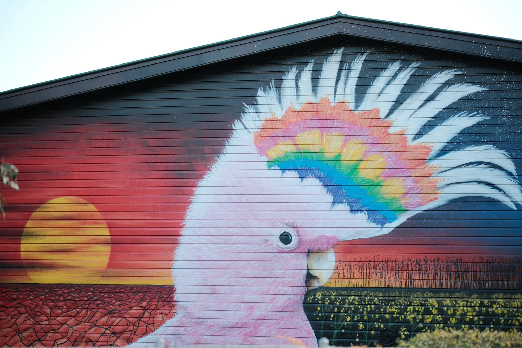
If you turn right at the corner and drive down about 100 metres, you will see this amazing Major Mitchell’s Pink Cockatoo mural painted on the side of one of the school buildings.
9.3km • The Cenotaph
9.4km • The Catholic Church, Nunnery Building and School Building on left
Barellan Sports Ground on the right
One of the activities which the community is involved in to support the Barellan Football and Netball Club, each year is growing a crop in a paddock just along the Leeton Road. Locals assist by donating grain, time, machinery etc to sow and harvest (strip) the crop each year and funds go to supporting the club.
9.8km • Opposite the corner is one of the four hospital buildings the town once had
Turn Left into Kooba St
Aged Care Units on right. Funded by the community members.
Turn Right into Bendee St
On the right is the Community Health Centre, Pre-school/Day care site. The town is now serviced by a doctor once a month and pathology services are also provided once a month. A travelling/mobile pre-school service provides opportunities two days a week for young community members.
Turn Left into Box St
Turn Left again at T-junction (Walter Burley Griffin Way)
10.9km • Commercial Hotel on left
The Commercial Hotel will celebrate its 102nd Birthday this year.
11.0 • The Big Racquet on right
Local Barellan farmer, David Irvin, was the driving force behind the construction of a 13.8 metre-long Big Tennis Racquet which stands boldly in the main street. The racquet was made to celebrate the 100th year of Barellan and its proud association with Evonne Goolagong-Cawley MBE AO. The Dunlop racquet is a scale wooden replica with Evonne’s autograph. Evonne Goolagong unveiled the wooden Dunlop racquet during Barellan's centenary celebrations on 3 October 2009.

The Barellan Museum on left
This will be open during the Good Old Days Festival weekend and although small, is worth a visit.

11.1km • CWA Rest House on right
The CWA rest house in Barellan, dating from 1924, is of state significance for being the first CWA Rest houses built by local country women in Australia. The name 'rest room' has often been confusing to outsiders, who have seen it as a coy term for public lavatories. The rooms certainly contained clean toilet facilities but went far beyond this. What the women of the CWA were creating in their rest rooms was a home away from home, where women could put their feet up, allow kids to roam free, make a cup of tea and conduct meetings in dignity and comfort. The Barellan CWA Rest house is run by the Barellan Branch of the CWA.
‘Norma’ the Clydesdale on right
The ‘Good Old Days Clydesdale Festival’ has become a highlight for the many people who return to visit year after year. The festival continues to grow and after receiving funding for the statue, it was named in recognition of the work of one of the founding committee members, Norma Zingle.
11.4km • Sheep Sale Yards on left
The original sale yards (on the right) were designed for the many thousands of sheep, pigs and cattle, that have been sold through Barellan over the years. In years gone by, sales were held every Friday. With the changes in technology, transport options and farming foci, sales are now held once a year, in the yards on the left, in February, with a targeted offering of first cross ewes. First cross ewes are generally a cross between a Border Leicester Ram and a Merino ewe – thus providing bigger lambs and broader wool.
11.8km • Turn Right onto the Weethalle Rd (Kolkilbertoo Rd)
If you are interested in a drive ‘up the road’, Weethalle has a great piece of Silo Art, that is well worth the drive.
11.9km • STOP before the Railway Crossing
12.4km • Turn Right onto the Golf Club Rd
Continue along here until you reach the crossroads near the silos and Golf Club House.
Turn Left and continue to the Showgrounds
14.1km • End