
Sandy Creek Drive: Good Old Days Festival 2026
The 2026 Good Old Days Festival officially kicks off on Friday, but we know plenty of you have already made yourselves at home in Barellan — welcome! It’s lovely to have you here for one of the town’s biggest weekends. If you’ve got a little time to explore between the festivities, there’s plenty to discover beyond the Showgrounds.
The Sandy Creek Drive takes you a little further afield, through the farming country surrounding Barellan. With agriculture and history at its heart, it’s a chance to get to know the landscape, the livelihoods, and the stories that have shaped this corner of the Riverina. Set aside a little extra time, pack something for the road, and get to know the district.
Looking for a shorter outing or choosing where to explore next? The Barellan Town Tour offers a closer look at the town itself and can be completed by car or bicycle.
If you need to fill up the tank before heading off, fuel is available 24/7 from South West Fuel, Barellan. For those travelling in an electric vehicle, there are EV Charging Stations located in Narrandera.
This tour has been contributed by Barellan Clydesdales Committee Assistant Secretary, Vicki Harris. Behind Barellan’s much-loved Good Old Days Festival is a committee with a passion for the town and its history. It’s their dedication that brings history to life for new generations each year at this iconic Australian festival.
Set your trip meter to 0.0km and follow the directions below. Please note, part of this tour is on dirt roads and not recommended after rain.
0.0km • Start
Start at the gates to the Showground. The Gun Club is on the left.
0.1km • Turn left onto Sandy Creek Rd
1.0km • The Concrete Bunkers on right
The Barellan silos are the second largest receival site in Southern NSW. During harvest, they average approximately 7000 – 9000 tonnes a day, with approximately 300,000 tonnes received in an average season. At the back of the silos are bunkers which are used as overflow areas, to meet storage needs during peak season. The silos in Barellan receive wheat, barley and canola.
5.0km • Wheat Crop on right
7.2km • Wheat Crop on left
If you have time while at the Good Old Days Festival, look in the pavilion behind the Office and you will see crops in various stages of development from seed to harvest.
8.2km • Canola Crop
In the week commencing 19 August 2026, this paddock was bright yellow, as far as the eye could see. The canola was in flower! By 12 September, there was limited yellow colouring on the plants and as you can now see, the flowers have gone and the heads (holding the seeds) are starting to dry out quickly.
9.1km • Wheat Crops on both sides
11.2km • Cropping properties sometimes take down boundary fences, because unlike sheep and cattle, crops don’t need to be fenced to be kept inside the boundaries.
13.2km • High Fence on left
High fences are sometimes built to keep deer or emus in paddocks. Sometimes they are used to hinder kangaroos entering the property.
14.3km • Causeway
This causeway has not had water over it in the last few years. Whilst many parts of this surrounding area was underwater two years ago at the start of harvest (late October), changes to paddocks and roads have left this causeway dry.
15.0km • Stock Feed on left
16.0km • Barley Crop
17.6km • Sandy Creek Monument on right
This monument commemorates the Sandy Creek Football Team, which was quite successful in their heyday. Sandy Creek is an area, as opposed to a town or village. The monument commemorates the team without a town. Just around behind the monument on the Genista Road (Eastern side) are the remains of the Hall and the Cricket Ground. The Fire Station is built on the original hall site.
WATCH OUT WHERE THE TAR MEETS THE DIRT. Rough road. Go straight ahead!
Genista Road is on your left (don’t turn). This road was covered by water, from end to end, for approximately three months in 2022, and was at times impassable, including at the start of harvest. Where did the water come from?
18.8km • Old Gravel Quarry
Farmers are responsible for maintaining the tracks within their properties and gravel needs to be available to keep the laneways and access tracks viable.
22.0km • Pasture
26.0km • Turn right Trembath Lane
Continue along Trembath Lane, keep left at Y-junction and stay on Trembath Lane.
30.1km • Grain Storage bag on far right
These white silo bags (up to 100m in length), provide farmers with an alternative to transporting their grain straight away, if they don’t have their sufficient permanent silos on farm. The grain can be kept for up to a couple of years in the right conditions. The grain is augured (piped conveyor) into the storage bags from the header or chaser bin, via a bagging machine which is attached to a tractor. The tractor slowly moves along whilst the bag is being filled. If you look closely, you will see a few of them in this part of the tour. Each bag costs around $1000 and can be used once.
32.0km • Lots of native shrubs
Three weeks ago, this road was full of whites and yellows as the native plants were in full bloom.
33.0km • Farm sheds
35.0km • Turn right at T-Junction onto Gunn Road
Lupins on the right
These are predominantly for stock feed and putting nitrogen back into the soil. Farmers have to be quite wary when harvesting this crop, as the dust off the plants goes through the harvester, it can combust and cause fire.
36.1km • Kangaroo Quarry
Used to maintain local roads.
36.6km • South Yalgogrin Hall Memorial
37.0km • South Yalgogrin School on right
Hop out of the car and walk through the school gates, you can still feel the atmosphere, even though the tanks and the remains of the garden and trees are the only visible signs.
37.5km • Prickly Pear Outcrop
These cactus family plants are a restricted invasive plant in Australia. You must not give away, sell or release them into the environment. In Mexico, they are eaten by both humans and animals. However, in Australia as we do not have prairie dogs, javelinas, iguana and coyotes, which have adapted to eat the prickly pear, so they can become invasive.
37.9km • Anthrax Vaccine Memorial
John Gunn built his own laboratory in 1890 on ‘Yalgogrin Run’ the property he was managing for R Goldsbrough and Co. Anthrax was the scourge of the industry at the time, killing more than 30 per cent of sheep flocks and other livestock, with more than 270,000 sheep known to be lost to the disease, in the Riverina District. The double dose vaccine developed in 1881 by the Louis Pasteur Institute in Paris, could not survive shipment or outback climatic conditions, and the regime of two vaccinations administered fourteen days apart was a particular problem on the sprawling Australian sheep runs. In 1897, John Gunn succeeded in producing a serum which was effective in one dose and could be kept almost indefinitely. His first attempt to reproduce the serum was unsuccessful, but fortunately this was achieved a few days later by John McGarvie Smith. The two men formed a partnership which continued until Gunn’s death in 1910.
38.2km • Sandy Creek Crossing
There were times two years ago when this crossing was completely under water. It can take up to four days for the full creek to reach the Sandy Creek Road Causeway, you travelled on about 10kms from Barellan.
48.0km • Lupins on right
50.3km • Stay Right on South Yalgogrin Road
This is a very well-maintained road, as it gets lots of traffic along it during harvest and sowing.
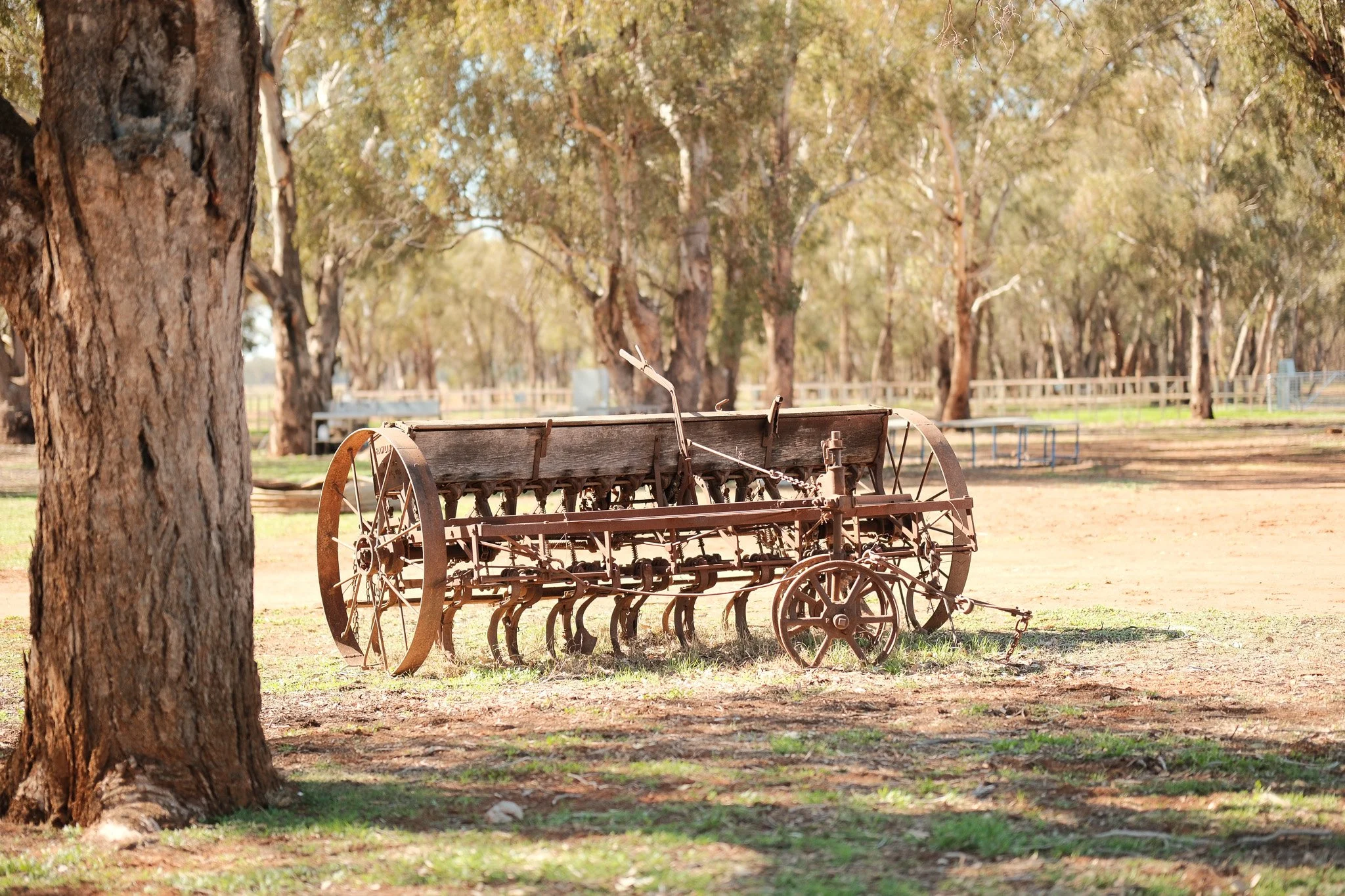
53.0km • Old farm machinery
Tractor, Header (for harvest), manual hand driven plough.
54.7km • Turn left onto Yalgogrin Rd.
STOP at the Stop sign as you cross the rail line. This rail line is used predominantly for transporting grain to storage areas in preparation for loading onto boats as export quality grain.
Turn right onto the Walter Burley Griffin Way and head towards Barellan. This road is named as it connects two of the cities that Sir Walter Burley Griffin designed – Canberra and Griffith. If you drive up the main street of Griffith to the ‘top end’ you will notice some of the circular joining roads that Burley Griffin was famous for.
55.0km • Moombooldool Sign on right
The plaque recognises the football, cricket and tennis players of Moombooldool district. The plaque also recognises the early pioneers. This plaque recognises the Football, Cricket and Tennis Players of the Moombooldool District. The Moombooldool Australian Rules Football Club was formed in 1912.
The first game was on the recreation ground was played in 1915. Prior to this, matches were played between teams made up of farmers, farm workers and station hands from the immediate area on a ground which was situated near Moombooldool-Willows Road north of the Moombooldool East homestead.
The Moombooldool Cricket Club was formed around 1915. Prior to this matches were played across the Mirrool Creek from ‘Rose Bank’ Homestead. The Moombooldool Tennis Club was formed around 1915. Prior to this, the sport was played on courts situated to the east of the village. Use of the courts ceased in the late 1940s.
The plaque also recognises and commemorates those who came before us and acknowledges the endurance and hardship encountered by them in the development of this area.
The village of Erin came into being with the arrival of the railway in 1908. Erin was renamed Moombooldool in 1912. Through its existence the village has boasted a railway station with a station masters residence, livestock loading facilities, general store, post office, telephone exchange, school, rural agency (which served Burnley Ale for sixpence a mug), grain, fuel & livestock agencies, two boarding houses and a public hall, church, Grain Elevators Board Receival Depot, Rural Fire Service, recreation ground with tennis courts in the south west corner, small golf course, a eucalyptus factory, branches of various farmers organisations and a branch of the Australian Workers Union. A bush hospital was situated 5km north of the village, on Glenora.
Continue onto Barellan a further 10kms along the road. Turn right at the Commercial Hotel/Silos. STOP at the railway line and follow the road past the silos to the showground.